 |
|
2007-'08 Historical Winter Snow in the Cascades and Eastern Washington
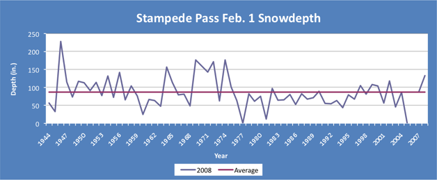
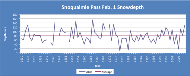
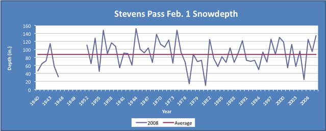
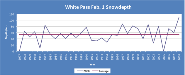
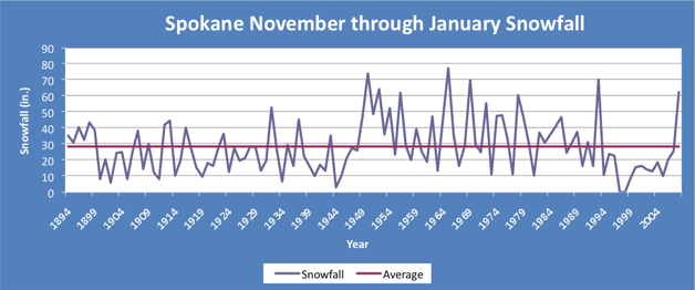
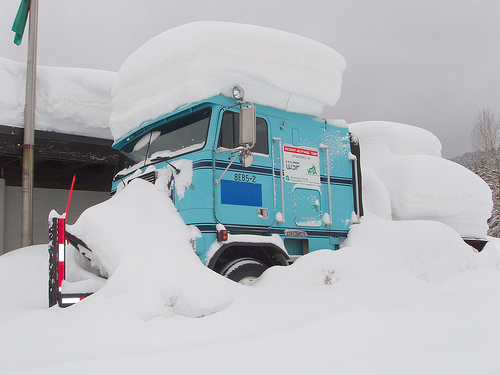 WSDOT photo of a snow covered RXtreme truck that is used to help push large trucks stuck in the snow. According to WSDOT, as of January 31, 2008 Snoqualmie Pass received five feet of snow in the last five days. Reminiscent of the 1998-1999 winter, copious amounts of snow have fallen across the Cascades this winter due in part to the moderate/strong La Niña in the equatorial Pacific. State transportation crews have been busy working to keep the mountain passes open, which have been closed numerous times due to avalanches and traffic problems. As of February 1, snowpack across much of the state is greater than 140% of normal. The biggest departures from average are in the central Cascades, particularly Stampede Pass, Snoqualmie Pass, and Stevens Pass, which have not had this much snow on the ground since 1974. Further, White Pass has a record February 1 snow depth of 110", surpassing the previous record of 88", and is also tied for the 3rd highest snowdepth ever at White Pass. Further east, many areas have also received impressive snowfall amounts that have not been observed in over a decade. In Spokane, over 62" of snow has fallen from November through January, more than double the average of 28.5", and is the 7th snowiest all-time for the November - January period.The majority of the snow fell in January, with over a 1/3 of the month's 40" total falling on the 26th and 27th as a cold front moving south from the Gulf of Alaska collided with a slow-moving moist stationary front from the south. How does this winter compare historically to an entire winter season in Spokane? Well as of February 1, if no more snow were to fall, this winter would be ranked the 20th snowiest winter dating back to 1881. Related Links
|


 |